Sunday, 27 November 2016

Walk 8 - Markfield to Shackerstone


We did this section of the walk on Saturday 26th November 2016.  We had booked a weekend break at Bosworth Hall Hotel who had a very good offer on so did this walk on the Saturday and the next part of the Round on Sunday. Although quite cold at about 7 degrees C, we had a fair amount of warm sunshine during the early part of the walk.  We were expecting very wet and muddy conditions after the very heavy rain earlier in the week but it turned out to be a fairly easy walk, mainly through woodland or grassland.  We planned a shorter than usual route as it is fast approaching the winter solstice and the days are getting shorter so need to ensure we finish before the light fades.

 
Markfield to Thornton

We left Markfield at around 10 am, somewhat later than usual, because we had a leisurely breakfast in the hotel before starting out.  After what seemed a very long walk down Main Street, Markfield and then through a housing estate, we eventually left the village and walked across fields and under the M1 motorway.  
Stone cottages in Main Street Markfield
Young woodland in Browns Wood


We went through newly created woodland areas which are part of the National Forest scheme.  One of these, Browns Wood, was initially planted in the winter of 2001/2 and the Heavy Metal Band, Iron Maiden, arranged with the Carbon Neutral Company to plant enough saplings to offset the carbon dioxide generated by their “Dance of Death” CD released in 2003.  Any mud underfoot was covered by the recent autumn leaf covering giving dry and comfortable walking conditions. 


On leaving Browns Wood we got sight of Thornton Reservoir although only walked along the very narrow north west point of it before entering the village.  The reservoir is no longer used for drinking water and was opened to the public in 1997 by Severn Trent Water. 
 
Thornton Reservoir
Thornton is a linear village lying along a scarp overlooking the Reservoir and means a settlement walled by strong hedges – thorn hedges.  St Peters Church dates from13th century and the village pub is The Reservoir Inn.

Thornton to Bagworth

We saw little of Thornton village and crossed the main road, down through a housing estate and past some small houses with paddocks of horses across grassy fields where there were still signs of the lovely autumn colours in the trees.  

Paddocks and stream on leaving Thornton


Autumn colours in the trees


Ivanhoe Line Phase 2

We crossed the former Leicester and Swannington Railway which was opened in 1832 and provided Bagworth with its own station.  It was closed to passenger services in 1964 but continued to be used for transporting freight.Since the 1990’s,there have been plans to reopen this part of the line, including Bagworth Station, as phase 2 of the Ivanhoe line, phase 1 of which runs from Leicester to Loughborough.  Phase 2 would extend the line from Leicester to Burton on Trent.

 
After crossing the line we entered Manor Wood, a 25 hectare wood first planted in 2002/2003 on land that was formerly used for crops.  The woodland continued into Bagworth Heath Woods, a more mature woodland before reaching the village of Bagworth, which has an entry sign on a very large rock saying “Bagworth – Village in the Forest 2003”

Sign on entrance to Bagworth Village


Bagworth to Nailstone

Unusual seat on the route near Bagworth, dedicated to "Sylvia"

Again we saw little of Bagworth except for a short walk along the road from the church out of the village and back onto farmland.  We then went through another very young woodland – Underhills Wood – planted in 2005/6


After this there were some really nice views of the surrounding countryside.  Gaps in the clouds gave some stunning sun rays shining through in the distance.  
View south over countryside showing sunrays through cloud gaps
 
We entered the village of Nailstone by All Saints church, a grade II listed building dating from the 13th and 14th centuries. 
All Saints Church, Nailstone

Nailstone had a population of 514 in the 2011 census.  We then made our way to the Bulls Head for a lunch stop only to find that it does not serve food so we decided to continue on towards Odstone. 


Nailstone to Odstone

The route out of Nailstone took us on a track to the north of the village and across the busy A447, Hinckley to Ibstock road.  We continued across grass and farmland with autumn sown crops to the small, very pretty hamlet of Odstone.  Odstone appears in the Domesday Book as Odeston which means either Odds Farm.village or a settlement on the protruding piece of land. Oddr is the old Norse for “point” so has a Scandinavian origin.
Houses in the hamlet of Odstone

 Odstone to Shackerstone

We walked down Hall Lane and passed Odstone Hall, a Grade II listed Country House with Elizabethan origins.
Odstone Hall
 
 
The last of the bikers continuing towards Odstone
The route then continued down a wide grass track which was heavily rutted by farm vehicles.  The ruts were very muddy, leaving just narrow strips of grass to walk on which made it rather difficult walking.  Whilst on this track we were surprised to suddenly see 3 motorcross bikes coming towards us riding in the ruts. They kindly stopped to allow us to safely pass them


From Bagworth the Leicestershire Round had shared the route of the Ivanhoe way and we found the waymarker signs mostly showed both routes but sometimes only one or the other which caused a bit of confusion.  We continued to follow the signs for the Ivanhoe way and turned left into a field which led to Shackerstone but then found that this was where the routes diverged and we should have continued for a bit longer where the correct route would have taken us into the village via the Ashby de la Zouch canal tow path.  The route should have taken us across the footbridge at Shackertone station but this was closed and an alternative route in place.


The nearest we could get to Shackerstone Station

Shackerstone is the home of the Battlefield Line Railway, a preserved steam and diesel museum, that runs trains to Bosworth Battlefield. The railway came to Shackerstone in 1873 and continued providing passenger services until 1931 after which only freight ran on the rails of the Ashby and Nuneaton Joint Railway. The line was finally closed in 1970 at which point the railway society restored the station and reopened the line to Shenton which is the terminus for the Boswort Batlefield and Heritage Centre.

Shackerstone also hosts a large family festival, usually in the first week of September that covers everything from vintage cars to aerobatic stunt planes.
The Ashby de la Zouch canal at Shackerstone 
 
Distance
We walked a total of  10.63 miles

Next Walk
The next walk will be from Shackerstone to Sutton Wharf on the following day, 27th November 2016.


Wednesday, 5 October 2016

Walk 7 - Mountsorrel to Markfield


We did this section of the walk on Sunday 2nd October and this was a very scenic and relatively easy walk, with quite long stretches on tarmac roads or gravel tracks.  After heavy rain the day before we went prepared for mud and wet conditions which was needed for parts of the walk but we did have a lovely sunny day which started at a cool 6 degrees centigrade but warmed up to a lovely 20 degrees towards the end.  We encountered a great many runners today, even in the muddy areas, something that has not happened on previous walks.  Maybe parts of this walk are popular running routes.
 

Mountsorrel to Woodhouse Eaves


War Memorial - Castle Hill
We left Mountsorrel at 8.30 am  and from the Buttercross walked up the hill, with Castle Hill on the left and the War Memorial cross at the top.  Further on we passed the remains of former granite quarries on the right. 
The Buttercross


We crossed a railway bridge from where we could see the new Mountsorrel Railway station.  This is a spur line of the Great Central Railway, which we were to see more of later in the walk.
Looking down to Mountsorrel Station from Bridge

Before long we had views of Swithland reservoir, which was built to provide drinking water for the city of Leicester.  This reservoir is very picturesque and has the Great Central Railway viaduct running across it.  This railway is a major tourist attraction in the area and steam and diesel trains run from Loughborough to Leicester stopping at Quorn and Rothley with some also going to the Mountsorrel spur, the station for which we saw earlier.
Swithland Reservoir - Great Central Railway Viaduct

Swithland Reservoic - Pumping Station

Swithland Reservoir

Shortly after leaving the reservoir causeway, we crossed the main line of the Great Central Railway.  It was only 9.30 and we thought it a bit early for trains to be running.  Up until this point the walk had been on tarmac roads or gravel paths, but we then turned into a field and found conditions underfoot going from one extreme to the other.  We walked through several fields of very high unharvested maize or sweetcorn, not sure which it was and from the previous days rain the ground was very wet, muddy and slippery so our pace slowed down a lot. 
Paul on footpath between fields of Maize

We eventually moved into grass fields with many dairy cattle grazing.  We heard the whistle of a train and looked across the fields to see the engine and carriages as they went under the bridge that we had walked over some time earlier.
Train on Great Central Railway

We continued across more fields to the village of Woodhouse Eaves which is a very attractive village at the side of Beacon Hill with a lot of very old character cottages and houses.  This makes it one of the most expensive villages in the county of Leicestershire.
Stone cottages in Woodhouse Eaves

It has several pubs and the village church is the Church of St. Paul, built in 1836/37.  There was a scarecrow event going on when we arrived and many of the villages had been quite creative with their scarecrows.
Scarecrow exhibit

Scarecrow exhibit


Woodhouse Eaves to Newtown Linford
As we left Woodhouse Eaves, we entered the south east part of the National Forest which is an environmental project started 25 years ago to create more woodland in the centre of England.  The remainder of this walk and much of the next is through the National Forest.

The walk bypassed Beacon Hill which is a pity as that is another very nice country park in the country with superb views from the summit.  A beacon has been lit on the hill many times over the centuries to give warning or to commemorate an important national event.  Many times over the centuries a beacon has been lit near the summit to give warning or commemorate an important national event.  During the Second World War the site was occupied by the Ministry of Defence and was used for training operations and the storage of munitions.  In 1947, the site was purchased by Leicestershire County Council to protect its value as a public open space and later was designated as a Country Park and has now become one of the premier visitor attractions in Leicestershire at the gateway of the National Forest.
The walk instead took us across Lingfield Golf Course, where we had to be very careful to avoid golfers teeing off as the path often crossed the fairways.  There were many people enjoying a game of golf and by now the weather was warming up. 

Lingfield Golf Course

We continued through Rough Hill Woodland, a National Forest site before arriving at one of the northern entrances to Bradgate Park.


BRADGATE PARK was first enclosed as a deer park around 800 years ago.  Extending to 830 acres of publicly accessible countryside the Park has a wild and rugged aspect that is rarely found so close to the city with dramatic rocky outcrops and gnarled old oak trees, many of which are well over 500 years old  The River Lin runs through the Lower Park and is a popular spot for picnics or just watching the deer.   
Old John Tower
We walked the short steep stretch from the park entrance to Old John Tower which is an 18th century folly sitting at the highest point of the park and is one of Leicestershires most famous landmarks.  We sat on the ledge around Old John for a rest, drink and snack before making our way down the hill. 


View towards Swithland Reservoir to Mountsorrel and beyond


On the way down we saw a large herd of deer enjoying the sunshire to our left and a few smaller groups further down.  As we neared the tarmac road that runs through the lower park, we could see the ruins of Bradgate House, one of the earliest brick-built country houses in England and the birthplace and childhood home of Lady Jane Grey, Queen of England for Nine Days in 1553.

Deer in Bradgate Park

Deer in Bradgate Park

We reached the path running through the park and walked along to the main entrance at Newtown Linford, seeing several more groups of somewhat tamer deer on the way. 
Deer in Bradgate Park

Instead of our normal pub lunches, we decided to stop at the Post Office Tea Rooms today where we sat in their gardens in the sun with a slice of cake and a drink.
Post Office Tea Rooms
Jean having well deserved rest in the sun


Newtown Linford is a linear village with the River Lin flowing through.  It has many old cottages with lots of character.  The village's name originates from the relocation of people when the Ferrers family of Groby turned Bradgate into a deer park. The people who lived within the estate were moved to the "New Town" - or hamlet as it would have been then. The village was first documented in 1293 and was previously known as "Lyndynford".   The villagers were all tenants of the Ferrers family, and later the Grey family
Thatched cottage in Newtown Linford

Water Pump in Newtown Linford

Newtown Linford to Markfield
We walked along the main road through Newtown Linford passing two pubs and some very old houses.  We left the village across a couple of fields and reached an area of fairly new woodland where much of the walk was along a shady path with trees either side.  This led to Johns Lee Wood, a local Scout camp and activity centre.

Tree Lined path between Newtown Linford and Markfield

We were nearing the end of the walk when we made a mistake.  We passed Tanglewood Farm Stables.  Although safely enclosed behind large gates, 3 very noisy dogs barked loudly and aggressively as we passed the gates and continued to bark as we walked along footpath on the side of the property.  We hurried to try and get out of their sight so that they would stop barking and we think we missed a sign where the Round turned sharp right.  We went straight on and walked along the left side of a large paddock of horses whereas the Round would have taken us to the right side and up to the A50.  We eventually found the path again on the A50 and completed the last part of the route to find out car which was waiting for us at the edge of Markfield Village.
Horses at Tanglewood Farm Stables

Markfield is a commuter village and dates back to at least the time of the Norman conquest.  It is mentioned in the Domesday Book under the name Merchenefeld with just 2 small households in 1070. In the 2011 census the parish had a population of 5681.   Markfield has a long association with the quarrying industry and has a particular type of granite, microdiorite named after it. The granite stone (microdiorite) 'Markfieldite' is a very hard granite found in the local area and used in roadstone and railway construction.

Distance
We walked a total of 11.36 miles and I clocked up 31,000 steps on my pedometer.
 

Next Walk
The next walk will be from Markfield to Shackerstone 9.5 miles or Market Bosworth 13 miles but this is unlikely to be until November as we do not have any free weekends in the coming weeks.


Sunday, 18 September 2016

Walk 6 – Frisby on the Wreake to Mountsorrel


We did this section of the walk on Saturday 17th September, so some weeks after the last walk.  A previously planned walk in August had been called off because the weather was too hot for long distance walking. 
 
Today it was considerably cooler than it had been over the previous week and the temperature had dropped by 15 or so degrees.  This was a very flat walk, in the Wreake and Soar river valleys with only a couple of small hills.  We crossed the Leicester to Melton Railway line 3 times, as well as the main London to Sheffield line.  We also had 3 crossings of the River Wreake and one over the River Soar so a day of railways and rivers!
 
This area is prone to severe flooding during long periods of rain so we wanted to get it completed before any possible future spells of rain which may stop us reaching our target of finishing the round during 2016.

As we arrived at the start, a fine drizzle set in and we had this for the first 2 hours of the walk.  This eventually cleared and although cloudy and dull for most of the time we had good walking conditions.


Frisby on the Wreake to Hoby

We left Frisby by the Old Cross Stump firstly through a recently ploughed field, then through fields of cows, sheep and horses. 
Recently ploughed field near Frisby
 
Just before reaching Rotherby, the path turned sharp right and took us over the Leicester to Melton railway line for the first time and then after a short distance crossed the River Wreake across a long narrow bridge. 
Train, with old style carriages, passing at the crossing
River Wreake near Hoby

Footbridge over the Wreake
 
We followed the river for a short distance before climbing a short steep hill into Hoby. 

Hoby is a small village that sits high above the Wreake.  We entered the village near All Saints Church which dates from the 13th century.  The book said we should go past both the church and the Bluebell Inn – the pretty thatched village pub, but that turned out to be the wrong direction so we did go out of our way a bit before finding the path out of the village. 
All Saints Church, Hoby
 

Hoby to Rearsby

The walk took us over grassland where we could see the course of the Wreake and the railway line below us until the path turned left towards the river.  We passed Thrussington Mill House, which seems to be in the process of renovation and then crossed the Wreake for the second time. 

Thrussington Mill House
 
River Wreake near Rearsby
 
We made a short stop here for a drink and snack.  It had stopped drizzling and we were able to remove our waterproof outer layers.  We walked alongside the river for a short distance before turning towards the railway line from where we could see Thrussington church and village on our right.  
Thrussington Church and village
 
We crossed for the second time and into the village of Rearsby.  From the tracks we could see the former Rearsby Station house and the level crossing on the Thrussington to Rearsby road.  Rearsby used to lie on main A607 road between Leicester and Melton until a bypass was built in 2004. 
Rearsby Level Crossing and former station
from our crossing point
 
We passed through a well kept grassed area with the grounds of St Josephs convent to our right, and made our way towards St Michael and all Angels church.  The walk took us along the side of the church down to a ford over the Rearsby’s Brook, a tributary of the Wreake.  We crossed over the brook by the old medieval seven arch packhorse bridge. 

St Michael and All Angels Church, Rearsby

Packhorse Bridge and Ford, Rearsby
 

Rearsby to Cossington

After leaving Rearsby, we crossed the railway for the 3rd and final time and then reach the River Wreake for the 3rd time at Rearsby Mill.  We passed through the mill grounds with the beautiful Mill House and Mill House cottage on our right.  Rearsby Mill is nearer to Ratcliffe on the Wreake than it is to Rearsby. 
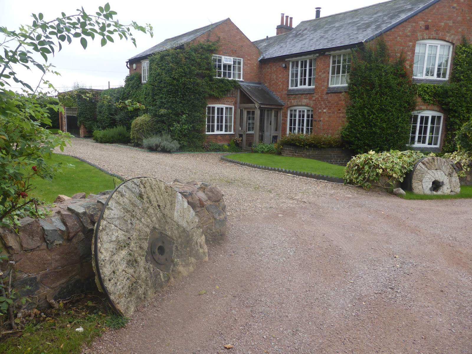
Rearsby Mill House


Rearsby Mill Pond
 
We walked down the drive towards Ratcliffe Road.  Before leaving the driveway to the mill the round takes a short cut across the field to the main road which cuts the corner off but we couldn’t get the gate open so walked the extra distance to the end of the drive instead.  The route then took us along a pretty tree lined track where we turned off just before Spinney Farm.
Driveway to Spinney Farm
 
We then crossed a field of sheep then uphill around muddy fields of newly sown crops to the A46.  At this point we had some great views to the east towards Burrough Hill, which we climbed on Walk 5.
Easterly view with Burough Hill to the right
 
Crossing the A46, a very busy dual carriageway, took a long time.  There was no real break in the traffic and we eventually had to make a dash for it when crossing each carriageway. 

Once across we went through a small spinney of young trees into the grounds of Ratcliffe College.  We left the college grounds and continued along tracks, sometimes muddy, until we reached the Cossington to Ratcliffe Road where we crossed the main railway line between London and Sheffield (over a road bridge this time) and into Cossington village where we had a very nice lunch at the Royal Oak pub,

Royal Oak, Cossington
 
Cossington is a small village with a population of 598 according to the 2011 census.  Every alternate Easter some of the villagers open their gardens to the public for “'Secret Gardens of Cossington'” event.  The village church is All Saints dates from 13th century.  Opposite the pub is a large white house where Lady Isobel Barnett, TV personality and presenter from the 50s and 60s (panellist on "Whats my Line") used to live until she took her life, in this house, in 1980 after being found guilty of shoplifting.

Former home of Lady Isobel Barnett

Cossington to Mountsorrel

The last 2 miles from Cossington to Mountsorrel was delightful as it passed through Cossington Meadows, a reserve owned by the Leicestershire and Rutland Wildlife Association.  The lakes in Cossington Meadows are formed from the old gravel works and we saw quite a few fishermen and bird watchers in the area.  It is certainly somewhere to go back to in the future. 
Heron and ducks on gravel pit lake
 
The walk took us out of the reserve and alongside the River Soar which we followed for some distance until we reached Sileby Marina and locks where tpart of the river has been “canalised”.
Sileby Marina

Sileby Locks

Paul taking a rest near Sileby Marina
 
After this the route became a little unclear and we ended up at an underpass.  There was a sign for the Round which would have run alongside the A6 but it looked very overgrown and virtually impassable.  The book tells us that there is a crossing point over the A6 further up but the underpass is an alternative.  After our experiences with the A46 we decided to take the underpass into Mountsorrel.

Mountsorrel village is situated on the River Soar.  It is home to one of the largest granite quarries in Europe and there is an overground conveyor that moves the stone from the quarry to Barrow upon Soar where it is sorted.  The centre of the village is marked by the Buttercross, site of the village market.

Mountsorrel Green


Distance

We clocked up 11.98 miles on this walk but some of this was due to us taking the wrong route in Hoby.  I remembered my pedometer this time and that registered 33,000 steps.

Next Walk
The next walk will be from Mountsorrel to Markfield, hopefully in 2 weeks time.