Monday, 1 August 2016

Walk 5 – Somerby to Frisby on the Wreake


We managed to get this walk in on Saturday 30th July just one week after Walk 4.  Another early start although the forecasted temperatures were far more comfortable than the previous walk.  This was a far more enjoyable than the previous one and signposting was far better although some waymarkers were hidden by hedgerows and trees.


Somerby to Thorpe Satchville
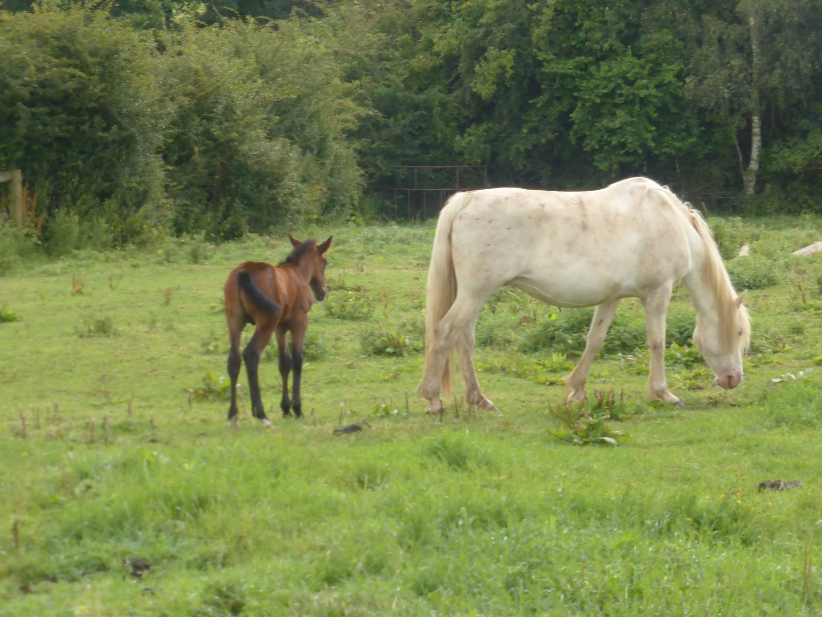

Horse and Foal near Somerby
Todays route took us out of Somerby in a northerly direction through fields of horses, sheep  and arable farmland.  Being very high up, we had some beautiful views of the area.
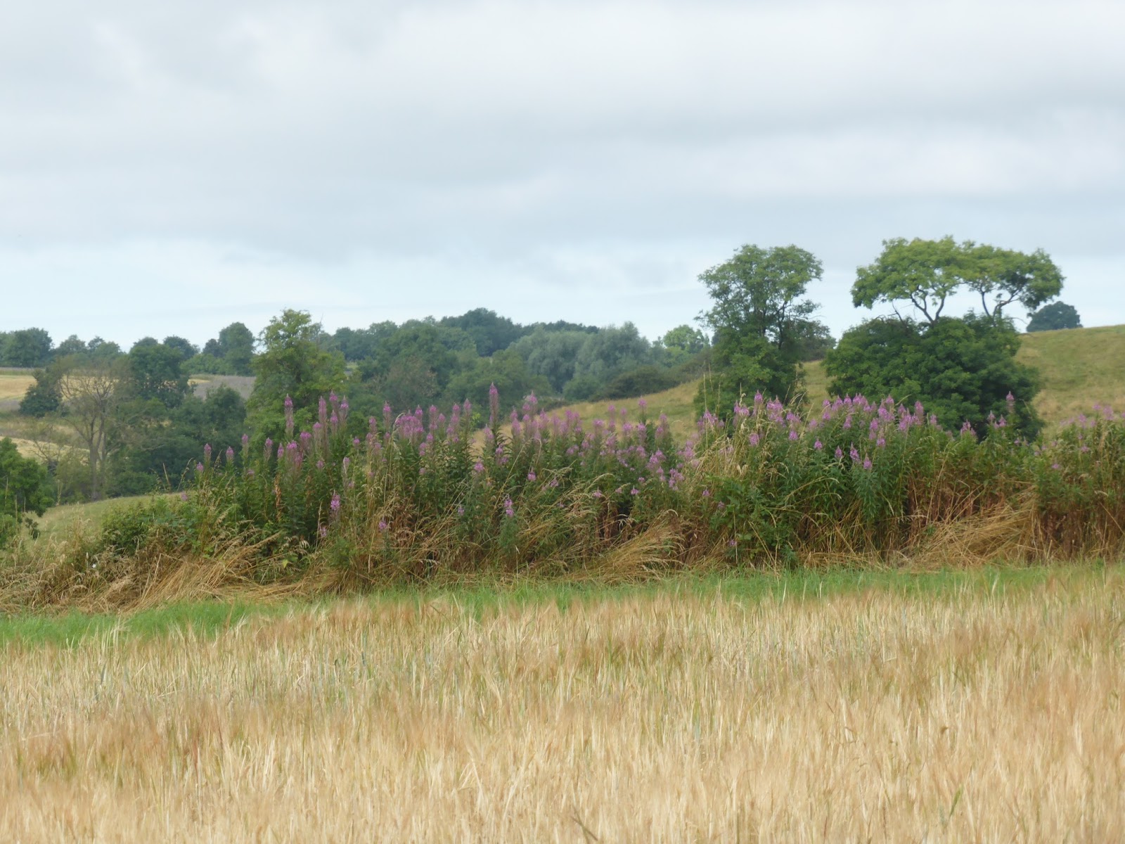


Countryside view near Somerby


Sheep in the kissing gate.  Paul said they were "baa'ing the way"
 
We arrived at the Ernest Cook Trust Permissive Path, which to our relief was marked as “Open”.  This path, when open, allows the Leicestershire Round to pass through the Little Dalby Estate, which is owned by the Trust and leads directly to the top of Burrough Hill.

The Ernest Cook Trust is an outdoor learning charity devoted to the conservation and management of the countryside and has estates in various parts of the UK.  It actively encourages children and young people to learn from the land through hands-on outdoor learning experiences on its estates and by offering grants.


Part of the permissive path went through woodland where we encountered similar extremely wet and muddy conditions as we did in Owston Woods on the previous walk but fortunately this time it was possible to walk away from the path on firmer drier land although this did not stop us from getting very muddy shoes and trousers. 
Sodden woodland track through the woods


Burrough Hill Country Park
View from Burrough Hill over Leicestershire.
 

After leaving the woods we crossed grassland and made our way to the toposcope at the top of Burrough Hill where we had some great views of the surrounding countryside.


Burrough Hill is an Iron Age fort situated on a hill near to the village of Burrough on the Hill.  It is 200m above sea level.  Many archaeological investigations have taken place there in recent years. The toposcope indicates places within view from this high point. 


Toposcope markings on Burrough Hill
 
 
Toposcope on the ridge of the ancient fort
 
 
From the toposcope we could see the onward route but either had a very steep scramble down a grassy bank or a more gentle stroll around the fort near to the Trig marker where we joined the undulating path to Thorpe Satchville.
We chose the latter.  As we got further away we had some really good views of Burrough Hill.  We left the farmland about a mile from the Thorpe Satchville and walked along a quiet lane past a couple of farms until we reached the village.


Looking back towards Burrough Hill
 
Thorpe Satchville is a small hilltop village and part of the civil parish of Twyford and Thorpe which had a population of  628 at the 2011 census.  The village church, St Michael and All Angels (Church of England) is Grade II listed and was built in the late 15th century. 

We didn’t see much of this village as the path took us straight out again through the grounds of the church.  We did made a short stop for a drink and snack on leaving the churchyard.
St Michael and All Angels Church, Thorpe Satchville
 
Thorpe Satchville to Ashby Folville

The route took us down a hill and under the viaduct of the former Market Harborough to Melton railway.  Much of this section was through undulating fields of sheep and then cereal crops as we got nearer to Ashby Folville. 

Inquisitive s
heep near to Ashby Folville

Gatekeeper butterfly


Lunch Stop at Cardington Arms, Ashby Folville
On arriving, we made a short detour to the Cardington Arms, sat in their well kept gardens and had a very welcome cider and a light lunch.


Ashby Folville dates back to the Domesday Book of 1086 when it was known as Ascebi which is Danish for the Place of the Ash Tree.  It is listed as having 24 villagers, 2 slaves, 3 smallholders, and one priest.  It was owned by Countess Judith who was related to William the Conqueror.  Folville was added to the name in around 1200 ad when the Folville family were Lords of the Manor.  The village church of St. Mary dates from 1220.

Ashby Folville Cricket Ground
Just opposite the pub is the village cricket pitch which is reputed to be one of the best in the country.


Ashby Folville to Gaddesby

The route then followed the path of the Gaddesby Brook for most of the way to Gaddesby, passing quite close to it in places. 
Gaddesby Brook

Ploughed field leading towards Gaddesby Church


Just before reaching the village we found the waymarker pointing over a recently ploughed field which was extremely hard to walk over and it was uphill as well making it even more difficult.


Gaddesby also dates back to the Domesday Book and was known as Gadesbi – a pastoral village with a mill.  St Luke’s Church was originally a Norman chapel and dates from the 10th century but was added to over the next few centuries.  The village holds an annual 5.25 mile cross country run, known as the Gaddesby Gallop on the Saturday morning before Christmas.

The Round did not go into the village but did pass the backs of some very nice houses with enormous gardens.

Gaddesby to Frisby on the Wreake

Oilseed Rape fields awaiting harvesting
The final stretch of todays walk took us through arable fields, including some oilseed rape fields which had grown over the footpath and made it very narrow.  Harvesting of oilseed rape was ongoing a couple of fields away and we were very glad that they were not working in this field today otherwise it would have been extremely dusty. 


We crossed the busy A607 – Leicester to Melton Road and walked downhill across one of the few fields of cows that we encountered today, to Frisby on the Wreake.

Frisby on the Wreake, is a small village in the Upper Wreake Valley with a population of around 600.  Parts of the village date back to mediaeval times.  The name “Frisby” is of Danish origin and means “settlement of the Frisians”. 
 
The “on the Wreake” part was added to distinguish it from another Frisby in Leicestershire.  The village cross used to be situated in the village centre but was moved to a safer site to avoid being further damaged by traffic.  A Time Capsule has been placed beneath it for the benefit of future generations.
The Village Cross


Row of cottages in Frisby on the Wreake
 

Distance
We covered about 11.9 miles today and have now completed approximately half of the Leicestershire Round.
 

Next Walk
The next walk will be from Frisby on the Wreake to Mountsorrel which we hope to do sometime in August.

Wednesday, 27 July 2016

Walk 4 – Belton in Rutland to Somerby


After another long gap since the last walk due to work patterns and other commitments, we did this section of the route on Saturday 23rd July during a very warm period of weather  We had both cars in place by 8.30 am and started off shortly after.  It was not the best of walks but more of that later.


Belton in Rutland to Launde Abbey

Belton in Rutland is a small village just off the A47 with a very run down looking pub – The Sun Inn.  It looks as if it closed down years ago and has been left in a state of disrepair but apparently it is still open and functioning.

The first part of the walk took us along a country lane out of Belton in Rutland passing a couple of farms before the path turned off and headed uphill towards Ridlington Ridge. We had superb views over the surrounding countryside. 

3 Horses came out of their stable as we walked
along the lane out of Belton in Rutland


The corn fields are getting quite high now.


Rutland countryside from Ridlington Ridge

View from Ridlington Ridge
The route took us over the ridge, down to the River Chater and up the hill on the other side for a short distance where we turned and followed the course of the river all the way to Launde Abbey. 
 
We were pestered by flies and some blood sucking insects for much of this section which made it very uncomfortable.  We kept feeling sharp pains in our hands or arms to find one of these creatures had punctured the skin and left a small blood trail.


Leicestershire farmland near Launde Abbey
One of the lakes near Launde Abbey


The gardens at Launde Abbey

Launde Abbey is an extensively modified Elizabethan manor house, originally built on the site of an Augustinian priory, Launde Priory. The original priory was founded before 1125 (in 1119 according to a modern inscription in the reception hall) by Richard Basset and his wife Matilda.  The chapel is thought to be all that remains of the original priory church. Some of its stained glass is mediaeval.  Today it is used as a conference centre and Church of England retreat


Launde Abbey and Entrance


Launde Abbey to Owston

After a short stop at the entrance to the Abbey, we eventually decided on the onward route, although the signs were not clear.   We continued uphill through a field of recently rolled hay bales where from the top, we had a really good view of the Abbey. 
 
View from top of hill towards Launde Abbey
 
The path was very rough in places and had us scrambling down a very short steep bank and up another equally steep bank before getting back to a normal footpath.  We reached the grounds of Withcote Hall where there were a few derelict buildings and a farm at which we were greeted by some very noisy but harmless little dogs. 
Ragwort was a common sight on this walk
bringing a lot of colour to the hedgerows.
 
After leaving Withcote,we crossed the road linking Tilton-on-the-Hill to Braunston-in-Rutland road and up towards Owston Woods.  It was very hot by now and we took a break under a big tree to have a very early lunch and dry off a bit as we were both in a sweat by now.  We were also looking forward to a bit of cooler air in the woods but were in for a nasty surprise.

As soon as we entered Owston Woods, the path became extremely muddy.  Keeping to the edge was not easy and to begin with there were no obvious other ways to get through.  We were wearing walking shoes rather than boots today because we didn’t expect to encounter any really wet conditions.  However for this stretch, we could really have done with boots and gaiters.  Eventually my left foot sunk about 6 inches into the mud and my shoe came off as I tried to lift my foot..  I lost my balance and my next step took me back into deep mud with just my sock on.  After retrieving my shoe and standing on one leg for ages while deciding what to do, I continued in just my sock until we found a bit of more solid ground.   I continue withjust one sock, which was a bit uncomfortable but there was no other option.  Next time I will pack some spare socks.
 
On leaving the woods we were again treated to some lovely views, this time over towards the village of Knossington to the north east.  We continued across farmland to the village of Owston.
Knossington Village and surrounding countryside


Owston is a small, pretty isolated hamlet with no shops and no pub.  The Parish Church of St Andrew, a Grade I listed building, was originally an Abbey and substantial buildings stood around the site of the current church.  Owston Abbey was never prosperous and eventually demolished with the exception of a part of a part of the Abbey Church which was retained by the existing church, resulting in an unusually proportioned building.

Our route took us right through the village where we passed some really lovely cottages and other larger houses and also past the old village well and a water pump with an inscription from 1907 to the memory of Frederick and Mary Palmer. 


Owston Cottages

The Well at Owston
Water Pump in Owston
 

Owston to Somerby

We left the village of Owston, following the Newbold Road for a while before the path again turned off over farmland towards Somerby. The final part of the walk was across undulating farmland.  At one point we walked through oilseed rape fields, which 2 months ago would have been bright yellow but were now a brown colour as they await harvesting.  About midway between Owston and Somerby we came across the only seat on this part of the route and rested for a few minutes before tackling the final climb up to Somerby.

Paul walking ahead of me alongside
a field of Oilseed Rape


Somerby is a small country village with a population of around 500. The surrounding area is referred to as 'High Leicestershire' as it is mostly several hundred feet above sea level.  During WWII, the village was used as a base station and testing ground for Operation Market Garden, the airborne attack on Arnhem.
 
We would have liked to make a short stop at the Stilton Cheese pub, but were too muddy and dirty from the episode in Owston woods so we will revisit another time.

 
Somerby Village with Stilton Cheese pub
on left hand side


Distance
We clocked up 8.9 miles on this section, but didn't get lost or go out of our way at all.  This time we used a compass when we were unsure of the onward path and this certainly paid off as the signposts are not always good.

Next Walk
The next walk will be from Somerby to Frisby on the Wreake, described as a strenuous stretch of about 11 or 12 miles.

Monday, 6 June 2016

Walk 3 - East Langton to Belton in Rutland


After a 2 month gap, we finally found the opportunity to complete the next leg of the Leicestershire Round on Saturday 4th June 2016.  Various reasons had stopped us continuing our challenge – working patterns, holiday, injury – but we finally found the time today.  The weather was perfect for long distance walking - fairly warm with a light breeze but a bit overcast.  It was quite misty all day so we were unable to clearly see the excellent views of the surrounding countryside which was disappointing.  This section was the most hilly so far and we seemed to be continually either ascending or descending a hill.  Throughout the walk the air was full of lovely birdsong including the Yellowhammer and Skylark.
 

East Langton to Thorpe Langton
We set off early from East Langton, which is one of a group of South East Leicestershire villages collectively named as “The Langtons”, the others being Thorpe Langton, West Langton, Tur Langton and Church Langton.  With the exception of West Langton, each has its own distinctive village pub.  This was quite a short easy section.  To our right there was a pretty fishing lake.  We entered Thorpe Langton at the side of St Leonards Church and took a short walk through the village, leaving it close to its village pub – The Bakers Arms.

 
Fishing Lake between East Langton and Thorpe Langton


Thorpe Langton to Stonton Wyville
This section took us over the Langton Caudle, a small hill to the north with a height of 147 meters.  On the map there is a shorter, flatter route to the west of the hill and may have been tempted to take this if we had been ending our walk, but we stuck to the route and were well rewarded with views, albeit misty ones, over the Welland Valley.  A windmill once stood on the top of Langton Caudle. On a clear day, it would have been possible to see all the Langton church steeples from the top – but we will have to make a return trip on a clearer day to see that.  The route up was a gentle climb and the caudle contains hedged fields so many of the views are not possible before reaching the summit, where there is a trig point.  The route down towards Stonton Wyville was much steeper

 
View towards Thorpe Langton from Langton Caudle


Paul at the trig point on Langton Caudle


Stonton Wyville to Cranoe, via Glooston
Stonton Wyville is a delightful little hamlet with its own church – St Denys - and a little stream running through the centre.  In the Doomsday book, Stonton Wyville was part of Hugh de Grandmesnil’s estate and was one of hundreds of manors given to him for his assistance at the Battle of Hastings.   


St Denys Church at Stonton Wyville
 
After a brief rest at the seat near the church we continued on across the fields following the course of the small stream to the village of Glooston.
Baa Baa Black Sheep
 
We entered Glooston via Main Street and passed The Old Barn Inn on our right which looks a very nice country pub and a row of early 19th century stone terraced cottages on the left called Adelphi Row.

The Old Barn Inn, Glooston
Stone Cottages of Adelphi Row, Glooston
 
The onward route to Cranoe was up a long straight uphill road between the two villages, only made more interesting by the very pretty display of white and yellow wild flowers along both sides of the road. 


The long straight hill from Glooston to Cranoe
 
Cranoe was once a much larger village which declined in the 20th century and now just contains a small number of houses and the Church of St Michael and all Angels, situated on top of the hill.  
We made our first mistake on entering Cranoe.  We saw a way marker for the Midshires Way but we didn’t see the pointer at the back of the same post for the Leicestershire Round which was hidden from our view so we continued down the hill, past the church before realising that we must have gone wrong.  We retraced our steps up the hill and from the opposite direction could clearly see the sign for Hallaton and got back on the right path.

Cranoe to Hallaton
This was the most frustrating part of the walk where, through lack of waymarkers, we lost our way. 

We crossed fields to Othorpe House but found ourselves in the farmyard which didn’t seem right. The farmer was working on a tractor and didn’t say anything except “hello” so we assumed it was right.  The map shows the footpath going right through Othorpe House!  On exiting we saw a way marker pointing around the edge of the farm.  We continued downhill and across a stream until we reached a point, around 1 km from Hallaton where we were faced with a very big grassed hill, with no visible waymarker to tell us which way the path went.  As the map showed it as a straight path from Othorpe, we guessed at the direction but made a mistake and ended up too far to the east in another field.  We could see Hallaton village but it was not possible to get out of this field so had to retrace our steps, through very long grass.  We eventually saw the waymarker some distance away and got back on track although this mistake was quickly followed by another due to a another missing waymarker near the entrance to the village.  We eventually arrived in Hallaton, about 45 minutes later than planned and desperate for a drink and something to eat.

Hallaton is the largest village encountered today.  We discovered that it has its own museum, and has a collection of 5000 silver and gold coins found in the area in 2000, now called the Hallaton Treasure.  It once had its own railway station.   Every year, on Easter Monday, it holds an annual "Bottle Kicking" competition which has existed for over 200 years between teams from Hallaton and nearby Medbourne.  The event has virtually no rules and the contest is for each team to move the bottles across two streams one mile (1.6 km) apart, by any means possible.  The contest is a rough one, with teams fighting to move the bottles over such obstacles as ditches, hedges, and barbed wire.  It started when 2 Hallaton ladies were saved from a raging bull by a hare who startled the bull.  They showed their gratitude by donating money to provide the poor villagers with Hare Pie, penny loaves and 2 barrels of beer.  The villagers then had to fight over the food and drink.  The villagers of Medbourne became involved one year and stole the beer which was the beginning of the rivalry between the two villages.


Hallaton Village Green

We stopped for lunch at the Fox Inn, next to the village pond which was home to several pairs of Mallard ducks, many of which had ducklings.
 
The Hallaton Village Pond


Hallaton to Allexton
We left Hallaton by the main road before re-entering fields.  We crossed much farmland where the path between undulating crop fields was very well marked from here on.  The path crossed the old Market Harborough to Melton Mowbray railway part of which has been turned into a cycle track, and continued on past Fearn Farm and around Allexton Lodge.  From here we could see (and hear) the busy A47.  The path went through a small area of woodland, which was pleasantly cool, before arriving in the very pretty small village of Allexton.

St Peters Church, Allexton
 
Allexton to Belton in Rutland
On leaving Allexton, we crossed the Eye Brook stream which forms the boundary between Leicestershire and Rutland. 

Crossing from Leicestershire to Rutland at Allexton
 
We crossed the A47 and made our way up the hill towards our end point - Belton in Rutland.  We made a short detour, towards the Church of St. Peter to find where our next leg of the walk would start before before reaching the car.  This village was originally called Belton, but renamed Belton in Rutland in 1982 to distinguish it from the other Belton in Leicestershire and another in neighbouring Lincolnshire. 
 
Distance
We did a total of 13.3 miles but at least 1 mile of this was because we went wrong 3 times.  The book says this should have been about 12 miles.  After our recent holiday to the Alpine region of Slovenia where we did several uphill climbs, we found this less tiring than the previous walk which at 12.25 miles was 1 mile shorter 

Next Walk
The next walk will be from Belton in Rutland to Somerby which we hope to do on Saturday 11th June.